The Can I Ride a Bus? section of the BusPlanner Web site allows users to determine whether they are eligible for bussing for a given address. This decision making process uses the existing schools, grades, policies, boundaries, and exceptions in BusPlanner to return to the user either a list of walking directions (if the student is not eligible for transportation) or a message that they need to contact the local transportation consortium to arrange transportation (if the student is eligible).

 Searching by Land Locations - Alberta & Saskatchewan
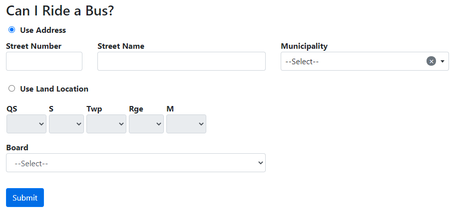
For clients in Alberta or Saskatchewan, you have the option to turn on searches by rural land locations: 1.In Settings, turn on UseLandLocation. 2.Users will then have the option to search by either address or land location:
Note: This will turn on the same option for Which School do I Attend?, as well as Address Eligibility and Student Search in the professional portal. |
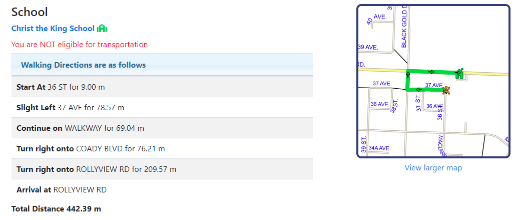
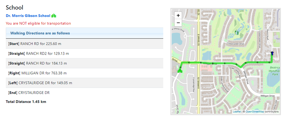
 Address Not Eligible for Transportation
•View School Eligibility – Links to the school’s entry in the Which School do I Attend? section of the webpage. See the Which School do I Attend? section for more information. •View Larger Map – Allows the user to see a larger version of the map on the result screen.For more information, see Maps in BusPlanner Web's Public Query. •Zones - If the address falls within any zones, they will be listed below. (For this functionality, enable Eligibility_ZoneType in Site Administration > Settings.) Note: School address, phone, and website information can be hidden by enabling Eligibility_ShowBasicSchoolInformationsetting in Professional > Site Administration > Settings. |
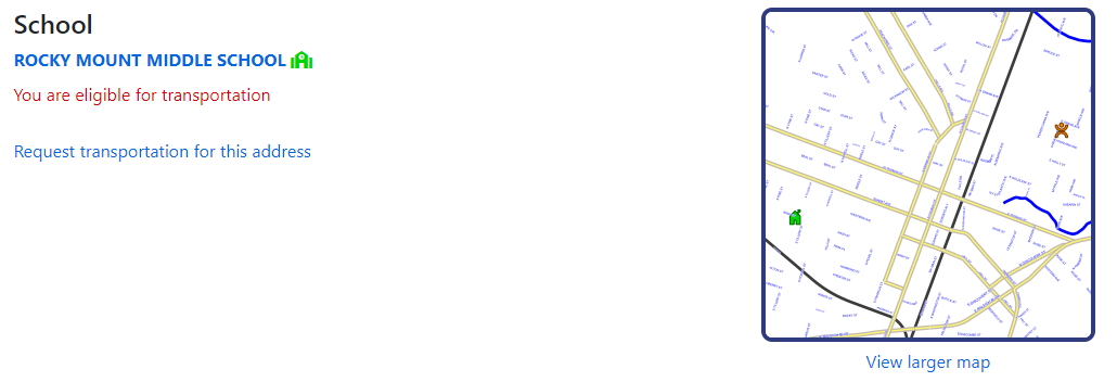
 Address Is Eligible for Transportation
After inserting this snippet, follow these steps:
•View School Eligibility – Links the user to the Schools entry in the Which School do I Attend? section of the webpage. See the Which School do I Attend? section for more information. •Zones - If the address falls within any zones, they will be listed below. (For this functionality, enable Eligibility_ZoneType in Site Administration > Settings.) |
 Address Is Eligible for Transportation – Show Stops
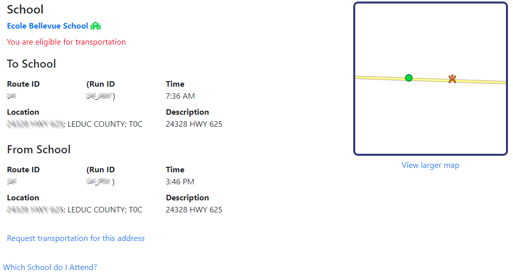
In BusPlanner Web, it is possible to adjust the site settings so that Bus Stops are visible to the general public when an address is searched. The example below shows an address with the Show Stops option activated.s
•Which School do I Attend – Links the user to the Schools entry in the Which School do I Attend? section of the webpage. See the Which School do I Attend? section for more information. •Zones - If the address falls within any zones, they will be listed below. (For this functionality, enable Eligibility_ZoneType in Site Administration > Settings.) |
 Failed Searches
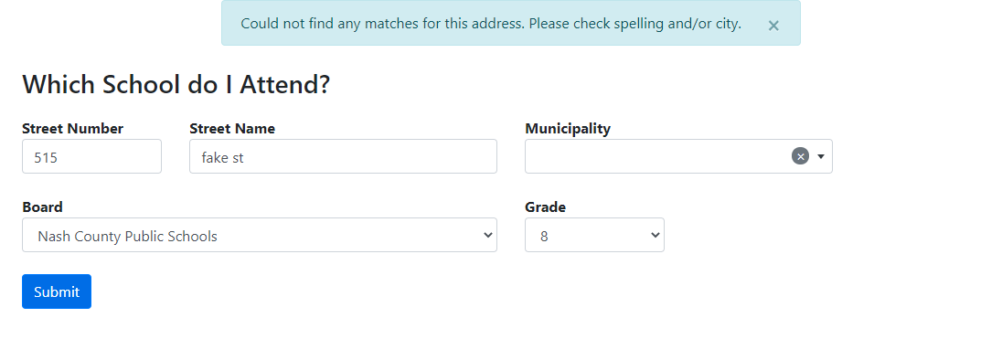
If the user has entered an address which does not exist in the database, they will be informed with an error message at the top of the screen. If they cannot determine what the proper spelling of an address should be, they should contact the local transportation consortium.
|
 Can I Ride A Bus Results - OpenStreetMap
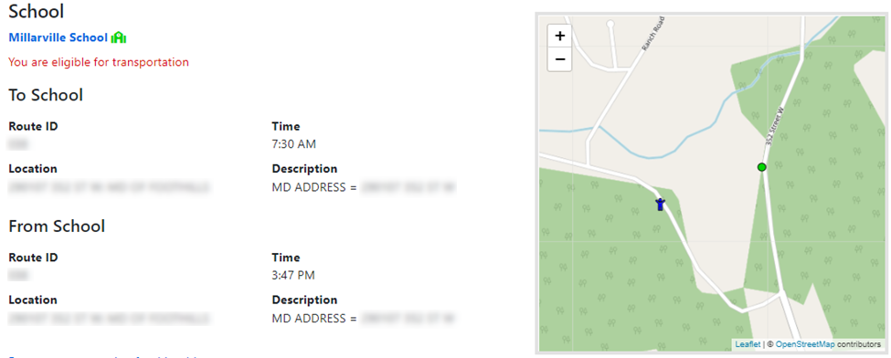
If your Can I Ride A Bus page uses OpenStreetMap as the base map, you can hover your cursor over the school icon in the list (green icon in the example below), and the map will zoom out to show how far the student is in relation to that school. This is not possible in the BusPlanner Map type. •Before hovering the cursor over the green school icon:
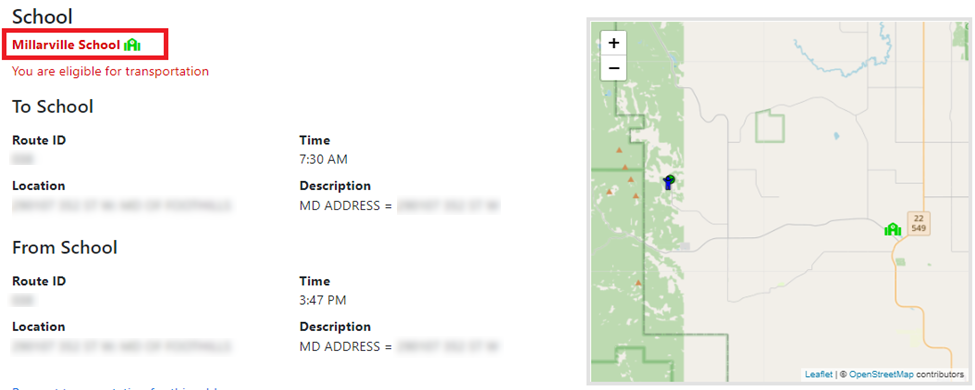
•After hovering the cursor over the green school icon:
For walkers, the walk path will be shown on the map:
|
